Geo Zone Technologies
Transforming Geospatial Vision into PrecisionReality
Unleash the Power of LiDAR and UAV Mapping for Unparalleled Accuracy.

ServicesWe Offer
Our dedicated teams of professionals work closely with our client and offer personalized and cost-effective solutions.
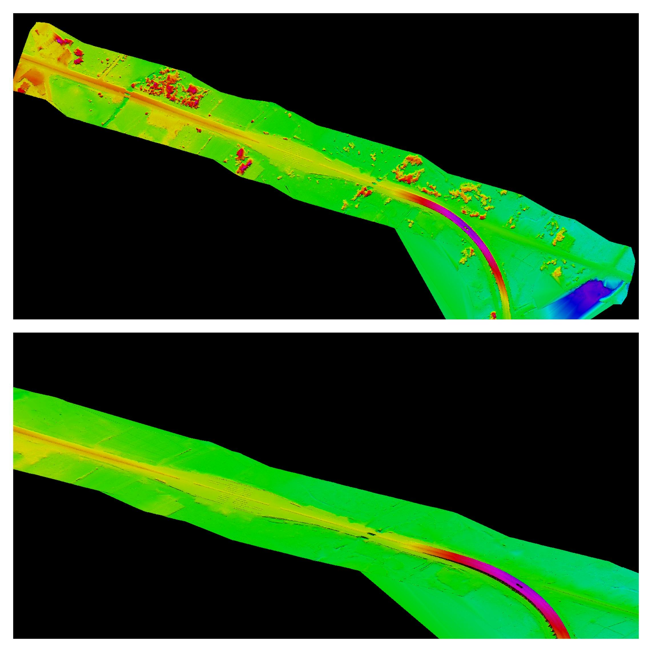
Mobile/Backpack/Airborne/UAV LiDAR Mapping
Enhancing Topographical Maps with Mobile LiDAREnhancing Topographical Maps with Mobile LiDAR
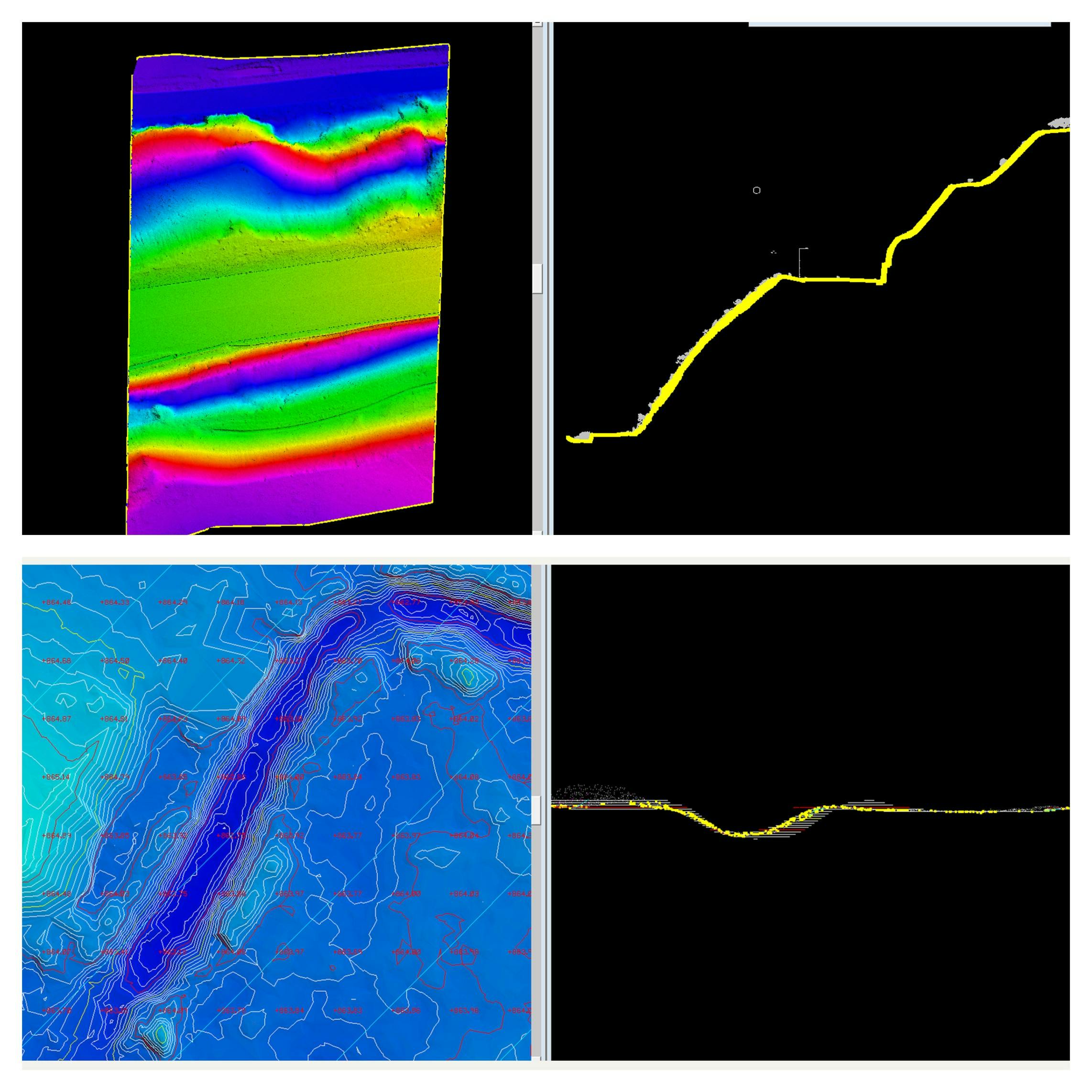
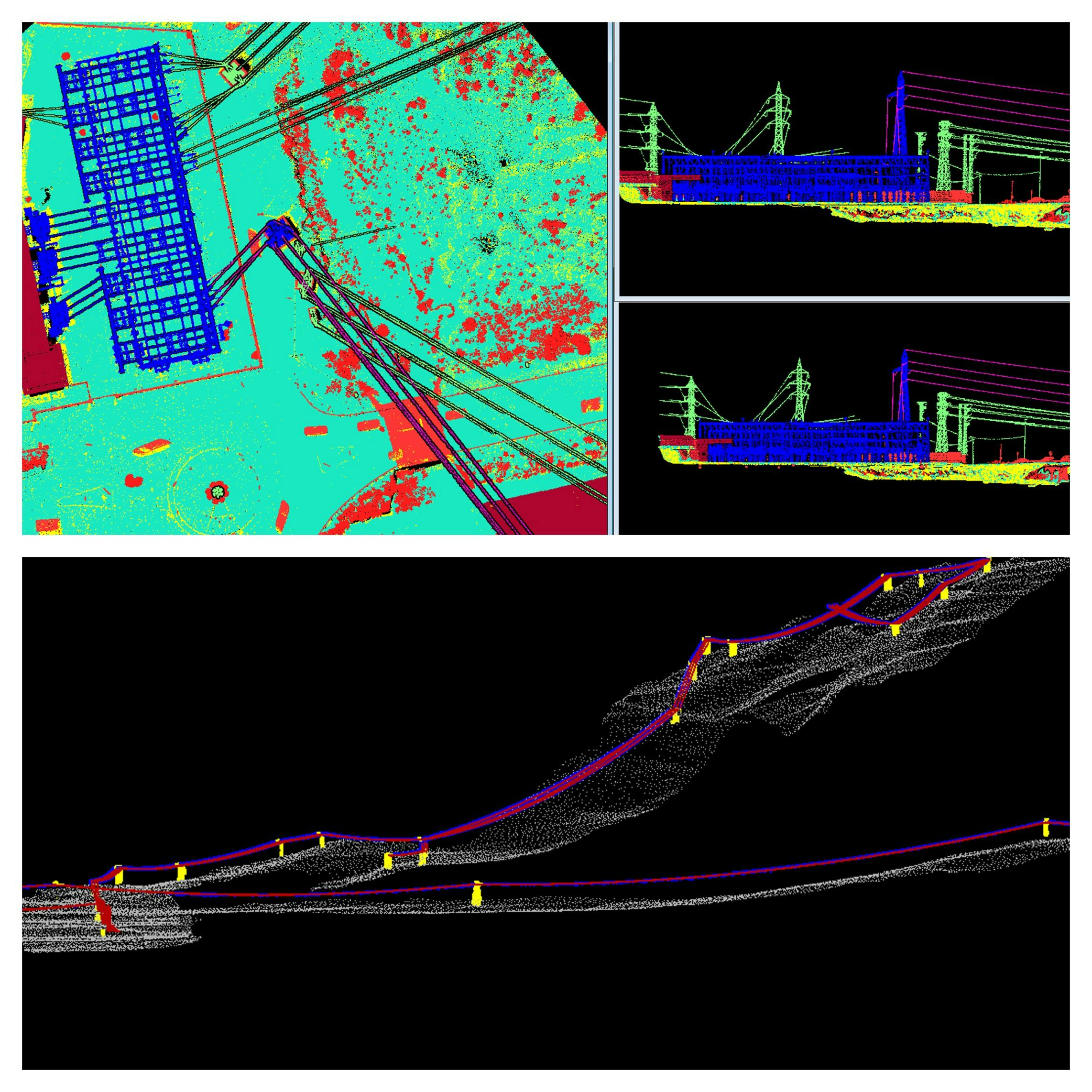
Point Cloud (LAZ/LAS) Classification
Ground Classification (Bare earth and non-ground classification). Advanced classification (Ground, Buildings, Roads, Powerlines, Man Made Features, Vegetation, Water Bodies Etc.)
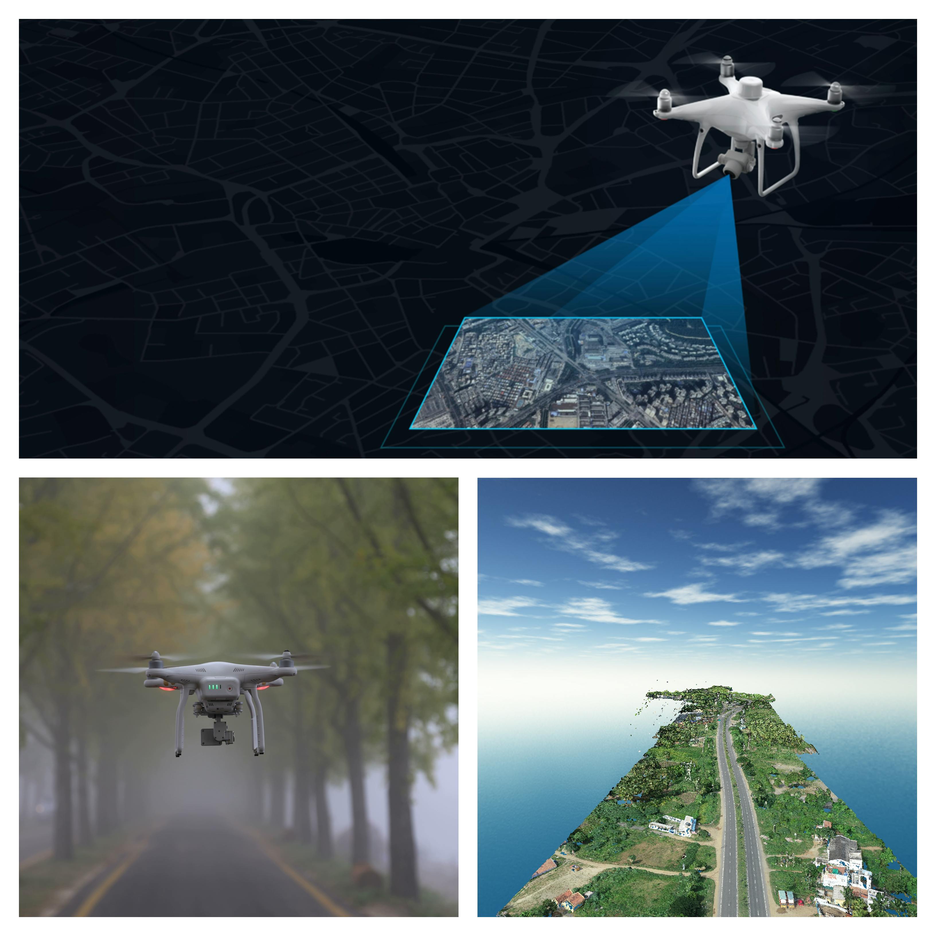
UAV Surveying, Data Processing and Mapping
Soar to new heights of accuracy and efficiency with our UAV (Drone) Surveying & Mapping services.
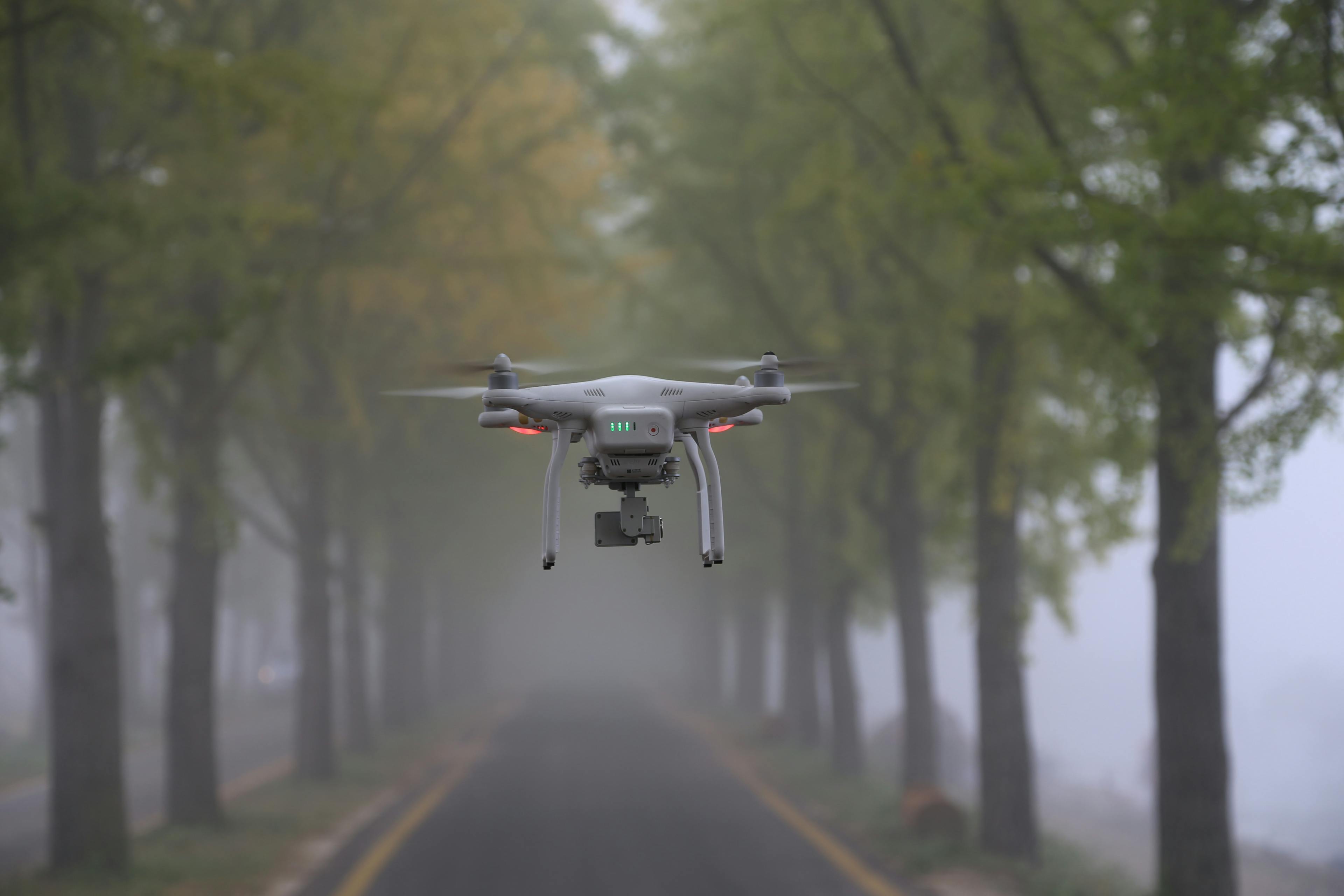
Drone Videography/Photo Capturing
Our team consists of skilled drone pilots with a passion for precision and creativity.
Videography Editing
Geospatial videography is a method that involves merging geospatial data with video footage to create lively and interactive visualizations that correctly represent spatial data.
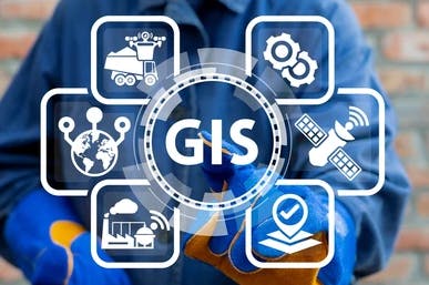
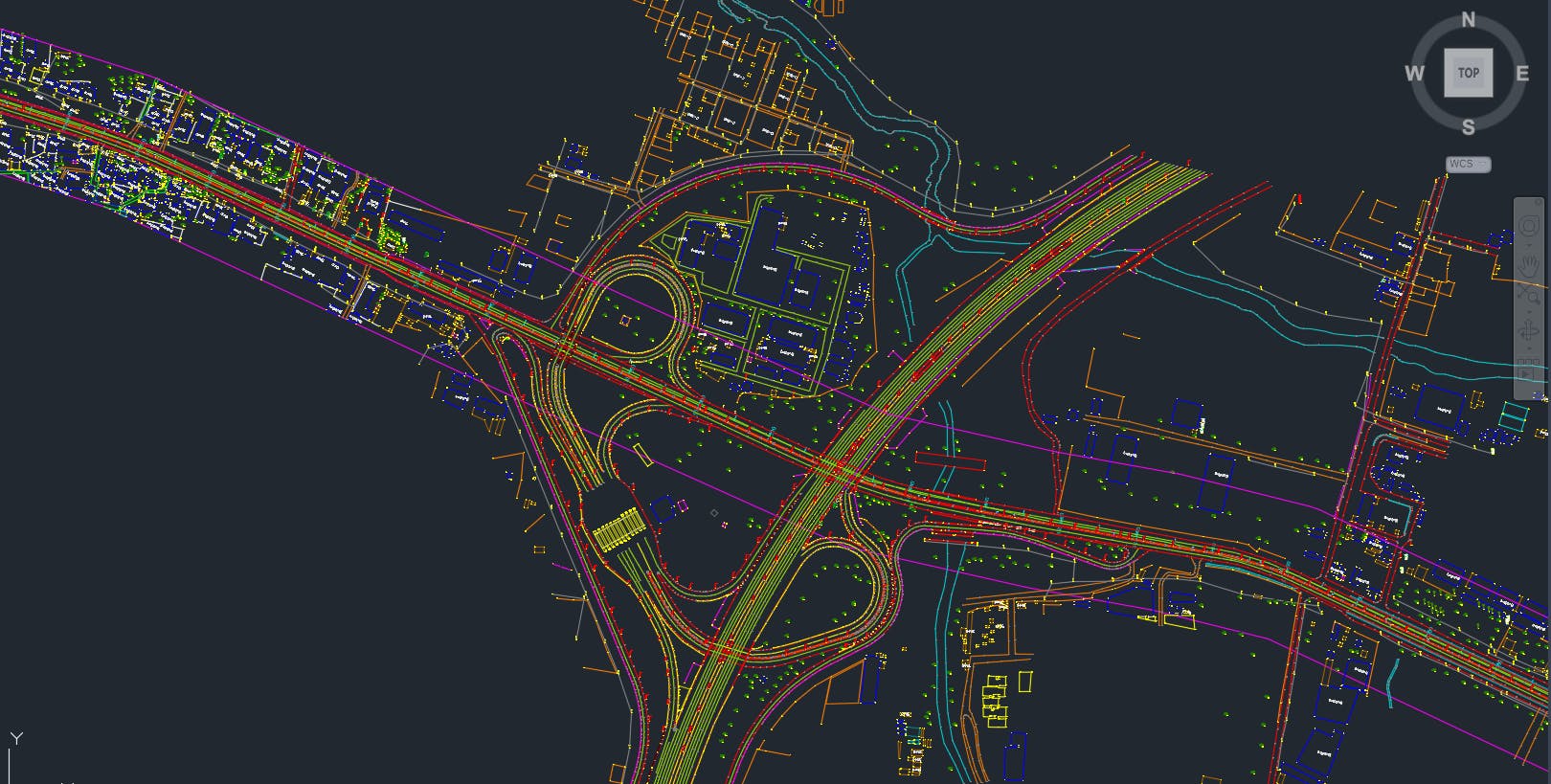
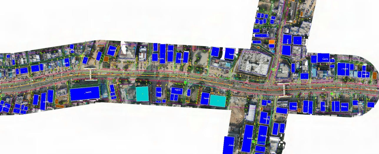
GIS Mapping & Data Conversion
Our GIS mapping services seamlessly integrate spatial data, enabling you to analyse, interpret, and visualize information in a geospatial context
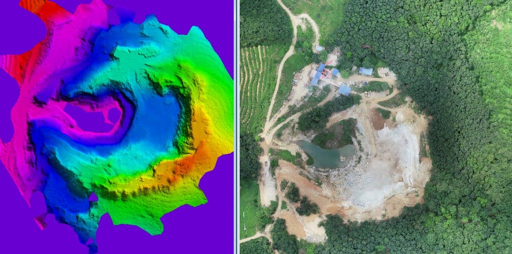
Surface Modeling and Volume calculation
3D models or point cloud data of the stockpile are used to calculate its volume. In grading and excavation projects, cut and fill analysis help optimize the balance between excavating and filling materials to achieve the desired terrain.

Rental Services (Drones/Computers/Laptops
Geo Zone offers Rental Services as well. We expertise in rental field and provide latest drones, computers and laptop throughout.

Training Services & Technical Help
We offer training courses designed to provide a complete understanding of data analysis methods on survey engineering, complete solution for mapping and software applications
Features
Geo Zone Technologies is your gateway to a world of precision geospatial mapping. Our comprehensive services span 2D/3D Mapping, Point Cloud Classifications, and UAV Surveying, driven by a commitment to productivity, quality, efficiency, and unwavering support. From topographic mapping to data processing, CAD, and GIS mapping, our technologically advanced software propels your projects to new heights.

Advanced Point Cloud Matching
Align LAS files with precision, matching flightlines and GCP points.
Seamless 2D/3D Mapping
Produce top-notch maps with ease, including DEM, DTM, DSM, TIN, and contour generation.
Photogrammetric Services
Expert feature extraction, ortho-rectification, and Geo-referenced imagery for detailed mapping.
Industries We Serve
Explore the diverse industries that benefit from Geo Zone Technologies' advanced geospatial solutions
Bridge & Tunnel Projects
For structural accuracy, we offer UAV (Drone) surveying and mapping services, along with point cloud matching and ortho rectifications. Our expertise extends to 2D/3D mapping and point cloud classifications for design and planning.
Industrial Projects
Geo Zone Technologies specializes in photogrammetric services for digital surface models, point cloud matching services for industrial site mapping, and training services for industrial survey engineering.
Smart City Projects
Our comprehensive mapping services utilize LiDAR technology, while satellite imagery services aid in smart city planning. We also provide GIS mapping services for efficient urban management.
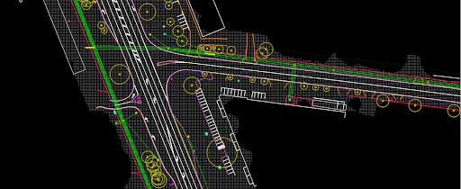
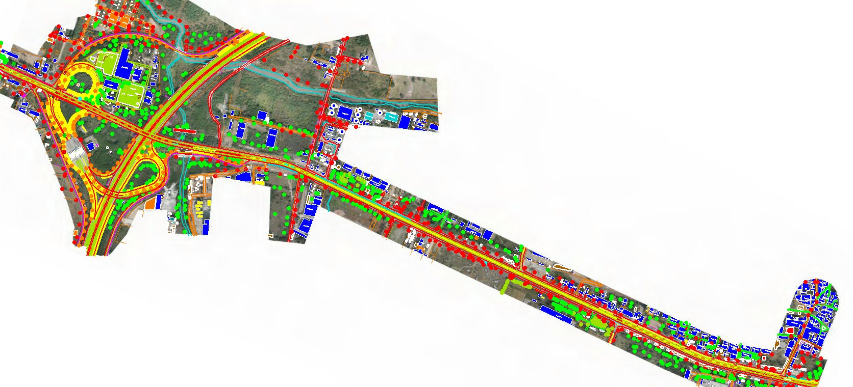
Highway Projects
For highway projects, we conduct topographic mapping using LiDAR technology, generate point clouds, and create orthomosaics for precise route planning. Additionally, we offer raster to vector digitization for accurate mapping.
Property Survey Projects
In property surveying, we excel in point cloud classification for detailed property assessments, 2D mapping and satellite imagery for property mapping, and geospatial information system services to support property surveying.
Railway Projects
Geo Zone Technologies provides Airborne LiDAR Mapping for precise topographical mapping, supporting urban development planning with advanced classification. Additionally, our services include power line classification and vectorization for rail infrastructure.
Unlock the Power of Precision Mapping with Geo Zone Technologies
Revolutionize your mapping projects with Geo Zone Technologies. From advanced point cloud classifications to seamless topographical mapping, experience precision like never before.